Welcome. A moment-to-moment story...
Showing posts with label Nature: Wetlands. Show all posts

4th Vernal Pool Certification!

A fourth vernal pool was recently certified in Spring Pond Woods!  This little pond with connecting wetlands and buffer areas is now regulated by many state and local laws as an important wildlife habitat.   


Last year, two vernal pools became certified, and back in 1997 the first vernal pond in Spring Pond Woods was acknowledged for certification.

Thank you to those who visited this area continuously over several nights/ days into months, gathering research.   Much love and peace on...

Vernal Pool Certification!!

Two (2!) vernal pool reports which were submitted last year for Spring Pond Woods, have recently become certified!  These two little ponds with connecting wetlands and buffer areas are now recognized by law as important wildlife habitats.   

Thank you to Leslie Courtemanche, who together visited the ponds over several nights/ days into months.  This is now Leslie's 3rd vp certification in Spring Pond Woods!  Another deserving thank you goes to Calvin Anderson who trekked along a couple times and helped discover the right kind of bugs.  Thank you to volunteers from a vernal pond group (Rick with Annette, Randall, and Rosemary) for visiting the pools during one of the days, and a professor from a state college who visited the pools before Spring to offer insight of vegetation, and to a sweet woman who came once out in the dark after surgery but could not continue the climb through the woods to reach the 2nd pool.  Thank you to a group of Salemites who offered encouraging support.  And thanks to a special expert for simply caring…you know who are.  Did I miss anyone?  A big thank You to family and friends for putting up with us (well me anyhow :), over the long course of the challenging couple years to protect these areas.  Much love and peace on...


Photos of the woods

These are of a few photos, BJoyceArt has shared of their experience through the woods.  The wetlands and springs are partially frozen.  Historic stone walls are of many scenes, which once divided early colonial settlement.


Thank you, Mr. Joyce

Mass GIS Data Maps update

OLIVER, an online program available to the public to view and extract Mass GIS data, has improved with a friendlier interface.  Some wetland data has increased and become more detailed than last year's data.

Using OLIVER online, as seen in this first screen shot, is The City of Peabody parcel on the Salem side, shaded in a light green.  This parcel abuts Camp Lion and the Dibiasi subdivision, and was purchased by the City of Peabody to protect the water quality of Spring Pond.  The wetlands, saturated soils and streams have a hydro-connection from Camp Lion, through the City of Peabody's Parcel, onto Spring Pond water supply.  Only in season of a high water table and excessive rain (like the Springtime), may the streams and connecting saturated soils be seen in a short period of a day or more.  There is some video footage available to share of this.

In this second map, additional resource layers are turned on to view Surface Water Protection Zones 1 and 2 surrounding the streams and Spring Pond.  These zones are part of a regulated area.  This is part of the watershed, where the land is drained by the streams into Spring Pond.  These zones extend onto Camp Lion and the rear of Wal-mart's site (indicated in light blue shade and cross hatch).  From onsite observations, it appears these zones may need to be extended to envelope entire stream systems.  

In the map below, the Pine Barrens layer (shaded in olive green) is shown to indicate the areas of intense surface drainage caused from the Pine Barrens (as Leslie reminds us) where ground cover composed of pine needles flushes water at a faster rate.  Onsite observations indicate there are far more pines on site than just within the boundaries of these two zones.

A new and interesting layer is provided by the National Wetlands Inventory Streams and Wetlands (NWI Streams).  This survey affirms stream connection from Spring Pond to the rear of Wal-mart's site!

If you don't believe me or have time to follow the streams and saturation levels in the wet Springtime, check out Mass GIS OLIVER online:  http://maps.massgis.state.ma.us/map_ol/oliver.php


Intro: Watertable

Most of our research and studies of the area's ecology have been concentrated above ground, of the hilly surface conditions that exist around Spring Pond:  woodlands, habitats, topography, wetlands and watersheds (Water Surface Protection Zones, Streams, Vernal Pools, flooding and drainage).  

When concerned with major projects (like the proposed Lowe's and expanding-Walmart) near important waterways around Spring Pond, The City of Peabody's water supply, the water cycle should be the front environmental concern.  Water is vital to life in many ways, and we need to work harder in protecting Spring Pond and the waterways around it.

One may say there is no water table below the rocky hills around Spring Pond, but there are ways to gather facts from boring logs.  In future posts, we will study the boring logs and site conditions from the proposed project (where a core sample of the earth has been taken x-ft below the ground surface).  The logs will tell us where the water table is, and if the results were taken in a dry or wet season.  The log results will define the physical characteristics of the soil conditions.  But before studying the underground conditions of the site, it is essential to understand the meaning of 'watershed', 'water table', 'aquifer', and 'ground water'.... and how close threatening projects are to these waterways.

Beginning with understanding ground water,  there is a hundred times more water beneath the earth's surface than there is in all the lakes and streams above the surface in the world.   Even fractured bedrock may contain and carry water as an aquifer through the voids of fractured bedrock.  Read more here from the USGS:  http://ga.water.usgs.gov/edu/earthgw.html
An example of under ground water through an aquifer, and surfacing in a valley as a stream or river. 


Wetland impact: East Stream

One of the biggest concerns of the area will be the impact on wetlands by proposed future 'developments'.   For example, one of the streams which flows into a waterfall is faced by the threat of a Lowe's building.  The impact to this stream alone is highly likely to exceed the 5,000 sf max. allowance in Massachusetts for impact on wetlands.

According to documents, the Lowe's impact on wetlands is said to be "4,585 sf".  
Refer Salem Citizens website for drawings and numbers:  salemcitizens.org/issues/Lowes/Front%20End%20Charts.pdf 
The summary of BVW "A", "B" and "C" in the image below equals 4,585 sf.

However...

...as one studies the amount of wetland vegetation within these given boundaries and measures the drawings, the amount of wetland affected exceeds 5,000 sf by a great number.  In my own personal investigation of the drawings, I've taken a conservative measurement to find the bvw wetland alteration is minimally 7,170± sf (excluding 'bank' area, and expanded work in buffer areas).  Others have found these numbers to be higher.  

A big question (for me at least) remains.  Are the flags in the field correctly drawn in plan?  It is discovered that some of the flags have duplicate numbers, and some of the measurements between the flags were shorter in distance than shown on the plan.  Theoretically, if this is true, this could possibly mean that the stream in plan is extended at the thinner portion, causing the top thicker end of the stream on paper to be excluded from the calculations of the affected area?  This is only a question.  The only way for me to understand the conditions in the field is to have someone verify the locations of the flags with a handheld gps locator that has an inch or less tolerance, or other method of survey.  But this investigation for me is not extremely important as we already discovered, that by measuring the drawings, the wetland alterations exceed the allowable limit by a great amount.

To measure the drawings:
Print the drawing below to scale (using the scale bar as a reference) and measure by using a series of triangles to calculate the affected wetland flagged area.  Or import the drawing into a drawing program, using the scale bar as reference, and then trace over the affected area using a polygon tool, resulting in a calculation of the area.  Use the drawing below found on Salem Citizens website (click here).


More wetland and meadow discoveries

Recent photos shared by Leslie Courtemanche.  

Small amphibian


 Two unidentified dragonflies courting

White Swamp Azalea

unidentified Butterfly

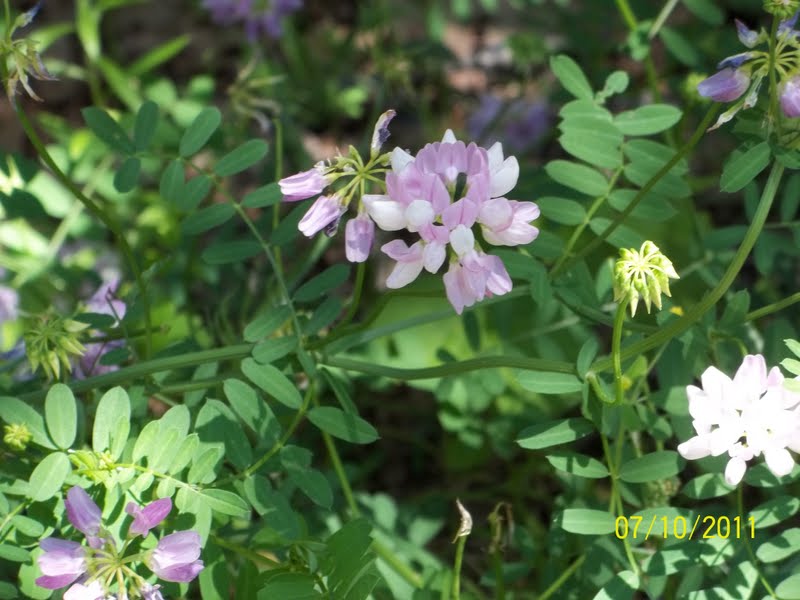
Flower

Log Cabin Caddisfly

The caddisfly larvae create a 'log-cabin' protective casing, using wood material.  They are important to vernal pools because they shred large leaves into smaller pieces which become usable by other species.  Their casings can be used to prove a dry wetland is a vernal pool.  It is amazing to see this insect's architectural abilities, in small scale.  

More wetland discoveries

Here are some daylight discoveries in the wetlands of a Redback Salamander and more Fairy Shrimp.

Potential Vernal Pool study, Part II

On Thursday, April 7th, the following species were observed in a potential vernal pool.  Different species are heard in the background.

At first sight, we could not understand why a 'stick' was moving in the water.  The 'stick' is formed from turned leaves.  Upon further observation, a larvae fell from the open tube.


Other species found in the same potential vernal pool...


Sounds of amphibians...

News: Abutter's concerns a snag for big boxes

Daily Item, November 11, 2010


(See, its important to not make inaccuracies or mistakes regarding wetlands.  Two years later, an appeal appears.  Click on article above to read more on the abutter's appeal.   :)

The ANRAD

Some people have been looking for the ANRAD (Abbreviated Notice of Resource Area Delineation) for 488 Highland Avenue, to appeal.  (Here is the link to the document:  http://springpond.us/Reports/ANRAD.pdf )

If anyone wishes to file an appeal, it can be done by either 
a direct abutter to the project, 
an aggrieved person (someone who will be adversely impacted as a result of the construction), 
or a 10 citizen group in the community (if one of the residents had made public commentary before).

For more information on how to appeal, see:  http://www.mass.gov/dep/service/appeals.htm


Issues in the ANRAD report (in my opinion):
  • The major wrong in this report is that there is more than 5,000 sq ft of wetland being affected, where only up to 5,000 is allowed.  
  • The delineation of a wetland was made in a cold month, an improper time to make a determination.  Back on Dec. 11, 2008, in a meeting with the Salem Conservation Commission, Terry Gensel from ENSR/AECOM requested to classify the designation of a wetland as "intermittent rather than perennial so there will be no surprises to the buyer or seller.  "A site visit was okayed at this request.. in the cold month of Dec-Jan, an improper time to make a determination of a wetland http://www.salem.com/Pages/SalemMA_ConCommMin/2008Minutes/S022A5291
  • There is no mention of Water Surface Protection Areas (related to water supply) or DEP Potential Vernal Pools, as seen from Mass GIS, which are near or in the project site.  


peace on

Topo Study of the hills around Spring Pond

          There is concern of having commercial or industrial 'development', especially businesses which have a history of pollution offenses, to be allowed on the hills surrounding Spring Pond, Peabody's Drinking Reservoir.

Lowe's history of offenses
Lowe's was fined a penalty by Mass DEP in April 2010 for polluting groundwater in Pembroke: www.mass.gov/dep/public/press/0410lowe.htm
Lowe's developer penalized by Mass DEP in May 2010 for violation of a wetland: www.mass.gov/dep/public/press/0510lowe.htm
Lowe's fined $137,500 by EPA for failure to adequately control storm water run-off at 4 Mass construction sites: click here


Walmart's history of offenses
MassDEP Assesses $8,000 Penalty to Wal-Mart for Violating Hazardous Waste Management Requirements at Four Central Mass. Stores in May 2010. www.mass.gov/dep/public/press/0510walm.htm


What the reps of Lowe's/ Walmart presented

In the last Public Meeting on September 30, 2010, the reps for the proposed Lowe's/ Walmart refuted environmental concerns by saying there is no record or potential for endangered species and there is no concern of the project related to Spring Pond.  A flat site plan was displayed, showing no topography, with only showing a dimension line from the back of the project to Spring Pond.  There was no indication of Mass DEP Wetlands or the Mass DEP 'Potential Vernal Pools' on the drawing.  There was no mention of the latest Peer Review provided for the project, which mentions concern for Spring Pond.  ( Is this the best the Walmart/ Lowe's reps can do, to represent an environmental study of the site?  Topography and wetlands should not be ignored when researching a study of the site.)


Concerns for Spring Pond
A recent Peer Review warns of the concern, the project might have to Proctor's Brook which flows to Spring Pond.


A precedent environmental mistake in 1996, cost the City of Peabody to clean the sludge from the Coolidge Avenue Water Treatment Plant, which accumulated to the bottom of Spring Pond.


A further  study, by an ordinary citizen...
The 3d model of the site above and the 2d site plan below, was created using data extracted from Mass GIS, in the software program Vectorworks Designer: Architect, Landmark, Renderworks. 

peace on

Peer Review shows concerns for Spring Pond


The Peer Review, dated July 1, 2010, made by the consultant for the City of Salem, discusses the review of the Kennedy Development Group project for Wal-Mart/ Lowe's on Highland Ave (in Spring Pond Woods).


There are a lot of questions raised in the report.  Most are undetermined.  The biggest regional concern is for the City of Peabody's drinking supply... Spring Pond.  In the report,  it mentions the rear portion of the building site is located within the Proctor Brook catchment of the North River, which may be tributary to Spring Pond.  It is not surprising, these waterways were not presented by the Lowe's/Walmart reps at the latest Salem Public Hearing, as the presentation only argued the project has no affect on Spring Pond.


From the report:

A concern with the above report, should note- to not have the applicant confirm delineation.  Someone with no stake in this project should do this.

Furthermore:
A further study from Mass GIS of an old map, c1900, indicates the streams and brooks on site, connect to Spring Pond.  As shown, Walmart (the old Rich's) is now built on a marsh...thus the flooding issues?  One water way is indicated behind Walmart's Parcel, and the other waterway is downhill from the Lowe's/'camp pad' site.


I wonder if the name of Proctor's Brook originated from the history told of an old landowner, by Spring Pond?

References:  

Inconvenient Truths

Update:  Checking the links to the City of Salem website concerning the meetings mentioned below, on September 16, 2010 it is found that the links to the pages have been 'broken' or 'changed'.   This post will be updated soon with the meeting minutes attached.
------------------------------------------------------------------------------------------

How to understand this?
How Salem is dealing with wetlands, in an appearing unrighteous fashion - helping development push through on pristine wooded, non-profit, open-space of camp ground.  5 questions remain.


---------------------------------------------------------------------------------------
    Back on Dec. 11, 2008, in a meeting with the Salem Conservation Commission, Terry Gensel from ENSR/AECOM requested to classify the designation of a wetland as "intermittent rather than perennial so there will be no surprises to the buyer or seller." A site visit was okayed at this request.   (For meeting minutes click here)
  • Q:    Can a waterway be determined by the Commission in one site visit, in a cold month of December for the advantage to the seller or buyer? 
  • A:    No.  According to Mass DEP 310 CMR 10.00: WETLANDS PROTECTION  (click here)  "proving that a stream is perennial by direct observation requires multiple observations made in the late summer and early fall months over many years.."
---------------------------------------------------------------------------------------

    Camp Lion's parcel was rezoned in 2009 by the City of Salem, resulting in giving the development of Lowe's and expanded Super-Walmart a go.  
  • Q:  Was this done illegally as spot zoning? 
  • A:  Hmmm....  From a statement mentioned in the Salem Public Hearing on Sept. 3, 2008, between Salem Council and the Planning Board, it states - "The catalyst for this ordinance amendment was the talk for the development of Camp Lion and Walmart."  (Meeting minutes click here ) 
---------------------------------------------------------------------------------------

     In 2007, Salem proposed an Open Space and Recreation Plan to preserve open space.  In it, Camp Lion is inventoried. It states strategies on how to go about preserving open space like Camp Lion. One of the important things it mentions is to  "Revise local Wetlands Ordinance to include the implementation of conservation restrictions on parcels developed adjacent to resource areas" (Reference on page 99)
  • Q:  Should we ask?:  Was Salem fully aware their local wetland ordinance needed to be updated in order to create more restrictions against development on open space... in 2009 when Salem rezoned Camp Lion's open-space parcel for development?   The Salem Wetlands Ordinance (from the 70's) did not become updated when the zoning was redone for "the catalyst" event.
  • A:  We don't need to ask to know the answer now.

---------------------------------------------------------------------------------------

     In the recent Salem Public Hearing on July 15th, 2010, the Development Group tried to say certain parcels, like Walmart’s lot need not apply for a wetlands special permit, because it was felt the property was not in a wetland/flood hazard district, according to the Salem local wetland maps (from the 70's that were not updated).   A person of the 'public', then commented at the hearing that the development should be following the latest wetlands maps by the DEP instead of the local Salem ones begin followed from the 70's... which does not have as much restrictions.

  • Q:  Is it pretend time and no one told me?

---------------------------------------------------------------------------------------

     Flooding and drainage:   Walmart's parcel is built on an old marsh.  Along with Highland Ave this area floods in a rainstorm. Please refer to the Mass GIS data layer for a historic map of c1900 showing a marsh in this area, or click here to view 3rd pdf.   The drainage system in both Salem and Lynn could not handle the water overflow.

  • Q.  Why isn't this area on the Flood zone layer?  And why is there flooding shown just over the line in Lynn and Peabody, but not in Salem?  Refer to Mass GIS or click here to view 2nd pdf. 
  • A.  Because it was not reported....  because?
---------------------------------------------------------------------------------------

Anymore questions?


To download poster:  For best quality, click to open (zoom in), then right-click to save.


Wetlands: Little ponds and marshes

This little pond is behind Walmart, where wetlands connect, where Walmart... 'maybe/maybe not'- a rep said... proposes to build a retention pond on these waterways (Surface Water Protection areasat the rear of the property.


This little marsh is to the left of the road, climbing up to Camp Lion's grounds from Highland Ave. A future road is proposed to carve near/on this.  Lowe's (as said from the last Salem Public meeting) proposes to use the wetlands to drain the parking lot... wetlands, which are designated as Potential Vernal Pools


...wetlands that stream to Spring Pond.  The slopes of this land are too complex for a large development. Please take a close look at the topography of the contours on the maps sloping down to wetlands of Potential Vernal Pools, which then slope down to Spring Pond.

peace

Spring Pond

Spring Pond Woods is one of the '1000 Great Places in Massachusetts'.   This list was created by an Act of the Legislature and signed into law by Governor Deval Patrick. Its mission is to identify and recognize the 1000 most truly special places in the Commonwealth, in order to celebrate pride in our history and culture, increase knowledge of our natural surroundings, and encourage regional interest to the site.

Spring Pond is on the Massachusetts Great Ponds list.  Spring Pond and the waterways abutting it are protected under Chapter 91:  The Massachusetts Waterfront Act.  Basically any project affecting the water or air quality, water levels or wetlands near Spring Pond is under this jurisdiction.

These are a few photos of Spring Pond from Spring till now...


peace

The Salem Public Hearing - July 15, 2010

Beginning:  Presentation of the Proposed Development 
An overview of the site is provided by the development group.  Indication of the drainage problems is realized for Highland Ave and Lynn neighborhoods by flooding.  There is no solution proposed, and no answers.  Wal-Mart proposed to withdraw from the Wetland Overlay district, because their rep says according to the Long wetlands drawings in Salem which were drawn in the 70's, the map does not indicate wetlands on Walmart's lot.  Lowe's development proposes to use the existing wetlands to drain the site. ( These two links *one* and *two* explain the reasons why I began to burn inside listening to this request. There are potential vernal pools here, and part of these wetlands drain into Spring Pond.  I can't imagine the parking lot grease and building run off flowing through this environmental gem).    

Commentary by the Salem Planning Board:
  • Wal-Mart is building a basin on a wetland.  The Rep replied - maybe/maybe not.
  • Is this the latest satellite image of the area and what is in this buffer zone?  The Rep said- This is the latest areal of the area.  (How come I can get the latest areal?  What was presented isn't showing the new opening at 'Apple Hills'. See Buffering page below)
  • It is understood there is flooding problems on Highland Ave.  Where does this water come from, and will Salem need to upgrade the Sewage pump to handle the excess water?  Answer: yes, the sewage pump will need to be updated by the City of Salem.  (I can tell you where the water comes from... see Drainage argument below - Walmart's building was built on a marsh in the past, and this area is in the valley of hills.)

Public Commentary follows...
Councilor Trahant of Lynn stood up first to say "See, this is what we have been talking about".  There are great drainage and flooding problems here already, and there is no solution if there is more water to be added to the drains... it will only make the existing problems much worse.
.....

Below are further arguments submitted to the Planning Board regarding Drainage/ Engineering/ Buffering and Architecture (by yours truly).  Comments by others in the crowd are organized with each category.  (Click on image to view, and again to zoom in). 

Drainage:  
Lowe's is not building on a flat site.  Look at the contours, the flow of natural water fills the wetlands and potential vernal pools.  Some of the natural water heads North and South of the site... into marshes and pools that stream to other pools, and then streams into Spring Pond.

A resident on Rt-107 said - in the presentation, the wetlands have increased since the 70's.  He then showed a map of wetlands from the latest Mass GIS data.  Lets not ignore the proposal is threatening to build over wetlands on these lots.

Two women from Peabody were present and said they were worried about the runnoff to Spring Pond, their drinking water supply, and asked if there would be studies done for this matter.


EMF Cellular Radiation Concerns
Building a water tower near a radiation tower? Drink dead water?
Condense the camp grounds near radiation tower?  What about the children?


Lighting Concerns

Buffering Concerns

Architectural Concerns
Councilor-at-large Cahill of Lynn asked to see a rendering of the proposed developments as one image. Currently the proposed Lowe's has been shown seperately from Super-Walmart.  If one looks frightening, then combining the two views will be double frightening.  


Concluding
Debra Walsh said that she concurs with Councilor Trahant. The flooding is a problem.  And there will be no camp.  The development will only provide a slab for the camp ground, but Camp Fire who rents from Camp Lion (the seller) has no money to build a building.  (So if Camp Lion is selling the land, where is the money going?)

Katerina Panagiotakis said this area has been voted by the public as one of the '1000 Great Places in Massachusetts', an act of legislation signed by the Governor.  If this place becomes destroyed it will be another layer of shame over this entire project.  The reason it was voted and won is because this area is loved by many people.

Leslie Courtemanche said that this area is loved by many people.  This development becomes a "Basis of Denial - when all the aspects are not met by the public, then it becomes a restriction."

One Lowe's supporter, who entered the room with a manager of Walmart or Lowe's said something like... "If they can make people go to the moon, then they can make this work".  (If I could speak twice... Only if man was able to make such a monstrosity work and non-existent to not disrupt the natural environment... then that will be a miracle in technology.)


Hearing to be continued to Sept 2.  Same time, same place.

Peace.

Threat: Development on wetlands

Shown below is an overlay drawing of the proposed threat of development, over wetlands and surface water protection areas.  The overlay includes pollution of dump sites on lots 1 and 2.  

As shown:
Lowe's proposes to build on DEP designated wetlands.  
Camp Lion's fields and the Water Tower are proposed on water protection areas.  
The storm water retention basin and road for Camp Lion is proposed to carve near an existing marsh.
The storm water retention basin for Super Wal-mart is proposed in the rear of the lot, over surface water protection areas, near wetlands.  

The latest map data was downloaded from Mass GIS, using OLIVER, and imported into the software Vectorworks Designer/ Architect.  Click on map above to view.

Streams

'Left over' earth surface, our surrounding cities have not paved over yet.  
Trails run into streams, which run to wetlands and waterways.